Larry Di Girolamo
Professor
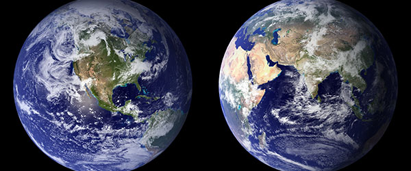
The atmosphere changes its face constantly as air moves around the globe—clouds form and evaporate, and the sun's energy is redistributed across the Earth as it rotates. The atmosphere is vast, and unfortunately it is impossible to directly observe in all but a few locations at specific times. To understand the atmosphere in all of its complexity, we need measurements through its depth, at many times and over its entire expanse. We cannot hope to make these measurements directly—the only way we can achieve this lofty challenge is through remote sensing. Satellite remote sensing of the atmosphere has become one of the most important techniques for observation of the global atmosphere. Satellites also provide opportunities to observe the entire surface of the Earth. This allows the changing patterns of vegetation growth, snow cover, and land use to be measured at frequent time intervals. It is essential that students today have a deep understanding of these powerful techniques of observation.
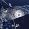
Students in the department employ a wide array of satellite remote sensing technologies to study an enormous range of phenomena. Students also do research with a wide array of satellite remote sensors, including instrumentation such as the spaceborne precipitation radar or microwave imager on NASA’s Global Precipitation Mission (GPM) satellite, and multi-spectral imaging radiometers such as MODIS, MISR, and ASTER on the NASA’s Terra satellite. Our department is at the forefront of satellite remote sensing technology with strong research connections to NASA. Opportunities to work with NASA’s advanced satellite instrumentation are available when you work with our faculty.